SAVANDURGA TREKKING. KARNATAKA.
Savan durga is a monolithic hill located around 60KM from Bangalore, it is located near Magadi road.The hill is considered to be one among the largest monolithic in the world and it rises to 1226 meters above sea level. The place is easily accessible from Bangalore and is easy to drive down.

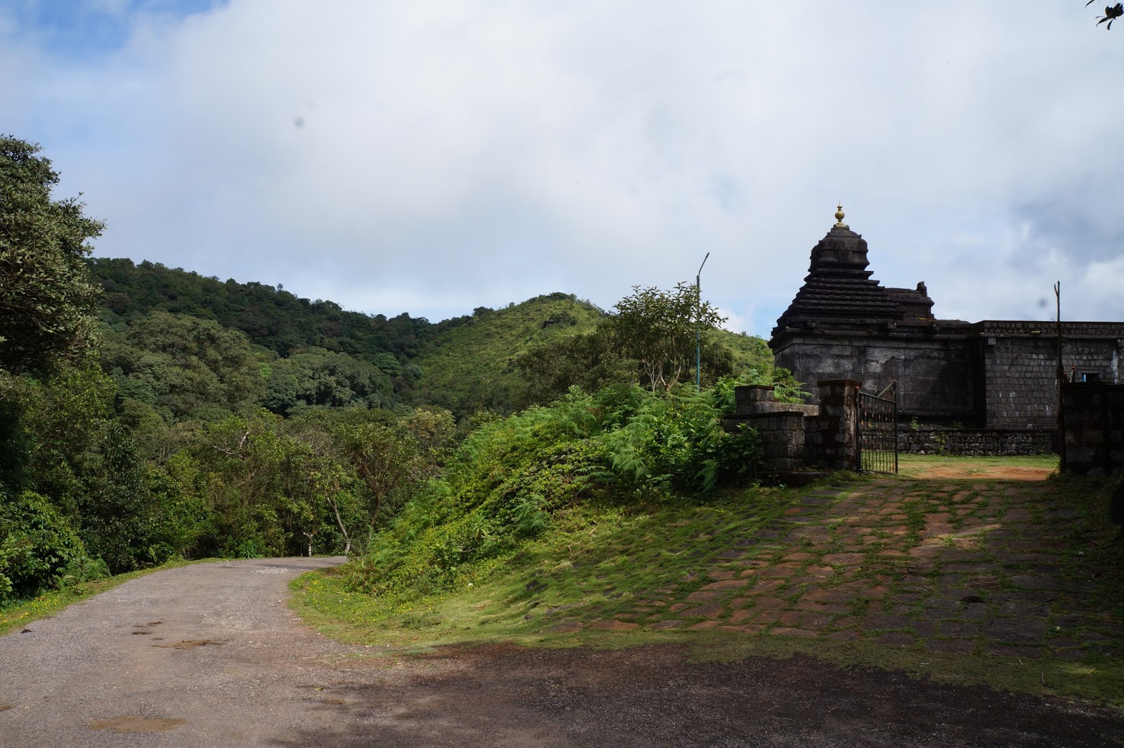
The place gets a lot of visitors almost all the seasons. There are two three temples on the way to the hill and one right below the hill. People usually visit the temple before starting the trek.Reach the location early morning as the sun rises it will be difficult to hike.
People of all age group and gender are found to be hiking to the hill but only few gets to the peak.
The place would be slippery during rain and trekking is not advisable during the rainy season.

We a group of eight members started our journey on a Saturday early morning from Marathalli and took the road toward Mysore road and took right on to the Dodda aladhamara road after Kengeri and proceeded towards Manchinbele dam and passed through the Savandurga forest and reached the destination around 7 am, we were late by an hour than the schedule as one of the bike in our group lost the way and others had to wait for them to join back. We started the hike around 8 am after visiting the temple and having a tender coconut. Carry your breakfast and water as its hard to get any thing to eat nearby.
The rock looks small from the bottom but there are multiple elevations on top of the main rock that we see from the bottom. It takes around 1.30 - 2 hours if you are hiking slowly. The rocks are slippery so you should be climbing in the direction that the other trekkers are taking.There are few places where the rock is too steep to climb, at such places they have made foot hols for the grip.
As you climb up a bit high the panoramic view will amaze you, there is so much of greenery around and you can see the river Arkavathy flowing at a distance. There are few remains of a fort wall on the way up, hope there were forts built by the rulers in the previous centuries.
As I said earlier there are multiple stages for this hike, we were on an intention that once we climb the first hill we are are on top of it, but once we reached the top of the first stage of the hill we could see there is much more to climb and the same repeated twice more.
Finally after a lot of sweating, we reached on top of the hill after around 2 hours slow hike, enjoying the view and taking pics. There were a lot of people including ladies and children when we started our climb but could see only 3-4 people on the top.There is a small Ganapathi statue on top of the hill and the view from here is fantastic. It is dangerous to go to the edge of the peak as there is no fencing at the edges. Be careful while taking selfies.
Its a good place to plan for a days trekking from Bangalore. Staying there is not advisable as there are no proper hotels near by. Start trekking early morning and enjoy sunrise from Hill top.

We pulled back after spending around 30 mins on top of the hill glancing at the beautiful view.
There were no hotels nearby so we had to drive back hungry stomach till Kanakapura and from there we filled our stomach and headed to Bangalore.
Carry at least some biscuits for breakfast,else you may have to starve till afternoon.
Click here to see map
Savan durga is a monolithic hill located around 60KM from Bangalore, it is located near Magadi road.The hill is considered to be one among the largest monolithic in the world and it rises to 1226 meters above sea level. The place is easily accessible from Bangalore and is easy to drive down.

The place gets a lot of visitors almost all the seasons. There are two three temples on the way to the hill and one right below the hill. People usually visit the temple before starting the trek.Reach the location early morning as the sun rises it will be difficult to hike.
People of all age group and gender are found to be hiking to the hill but only few gets to the peak.
The place would be slippery during rain and trekking is not advisable during the rainy season.

A View from half the way.
The rock looks small from the bottom but there are multiple elevations on top of the main rock that we see from the bottom. It takes around 1.30 - 2 hours if you are hiking slowly. The rocks are slippery so you should be climbing in the direction that the other trekkers are taking.There are few places where the rock is too steep to climb, at such places they have made foot hols for the grip.
As you climb up a bit high the panoramic view will amaze you, there is so much of greenery around and you can see the river Arkavathy flowing at a distance. There are few remains of a fort wall on the way up, hope there were forts built by the rulers in the previous centuries.
As I said earlier there are multiple stages for this hike, we were on an intention that once we climb the first hill we are are on top of it, but once we reached the top of the first stage of the hill we could see there is much more to climb and the same repeated twice more.
Finally after a lot of sweating, we reached on top of the hill after around 2 hours slow hike, enjoying the view and taking pics. There were a lot of people including ladies and children when we started our climb but could see only 3-4 people on the top.There is a small Ganapathi statue on top of the hill and the view from here is fantastic. It is dangerous to go to the edge of the peak as there is no fencing at the edges. Be careful while taking selfies.
Its a good place to plan for a days trekking from Bangalore. Staying there is not advisable as there are no proper hotels near by. Start trekking early morning and enjoy sunrise from Hill top.

We pulled back after spending around 30 mins on top of the hill glancing at the beautiful view.
There were no hotels nearby so we had to drive back hungry stomach till Kanakapura and from there we filled our stomach and headed to Bangalore.
Carry at least some biscuits for breakfast,else you may have to starve till afternoon.
Click here to see map